While not the closest summit to my home QTH, Point Reyes Hill W6/CC-071 was a perfect peak for my first ever SOTA activation. Before heading out, I checked the previous activation reports to get an idea of what to expect.

Point Reyes Hill is an easy drive and walk up using the Mt. Vision Road approach. You could also do it “the hard way” by taking one of the many hike/bike/equestrian trails that crisscross this part of Point Reyes National Seashore.

Mt. Vision Road is a narrow, one lane road that gets more narrow as you go up. There are many switchbacks and undulations as the road accommodates the mountain terrain. But if you take it slow it’s no problem, even for lower ground clearance vehicles.
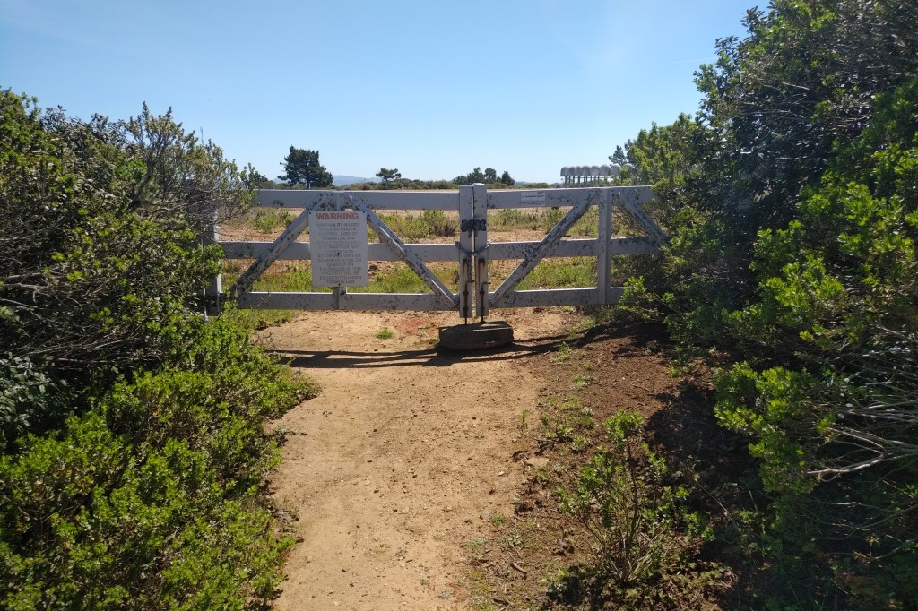
There is a wide pull out area for parking on the east side of the road at the point where a gate blocks further public vehicle access. We were the only car here when we arrived on this sunny Saturday morning.

I’d stowed a lot of radio gear and antenna options in the trunk of the car for the day’s outing. Before continuing, I selected the Mountaintopper MTR-4b and EFHW/fiberglass mast to carry to the summit.

Now on foot, we continued past the gate, up through pine shaded grades, before emerging onto the brushy and mostly flat summit area. Before heading out, I reconnoitered the activation zone on the N6ARA activation.zone website and downloaded the GPX file to the Garmin Explore app, but as it turns out the most likely operating positions are quite obviously in the zone.

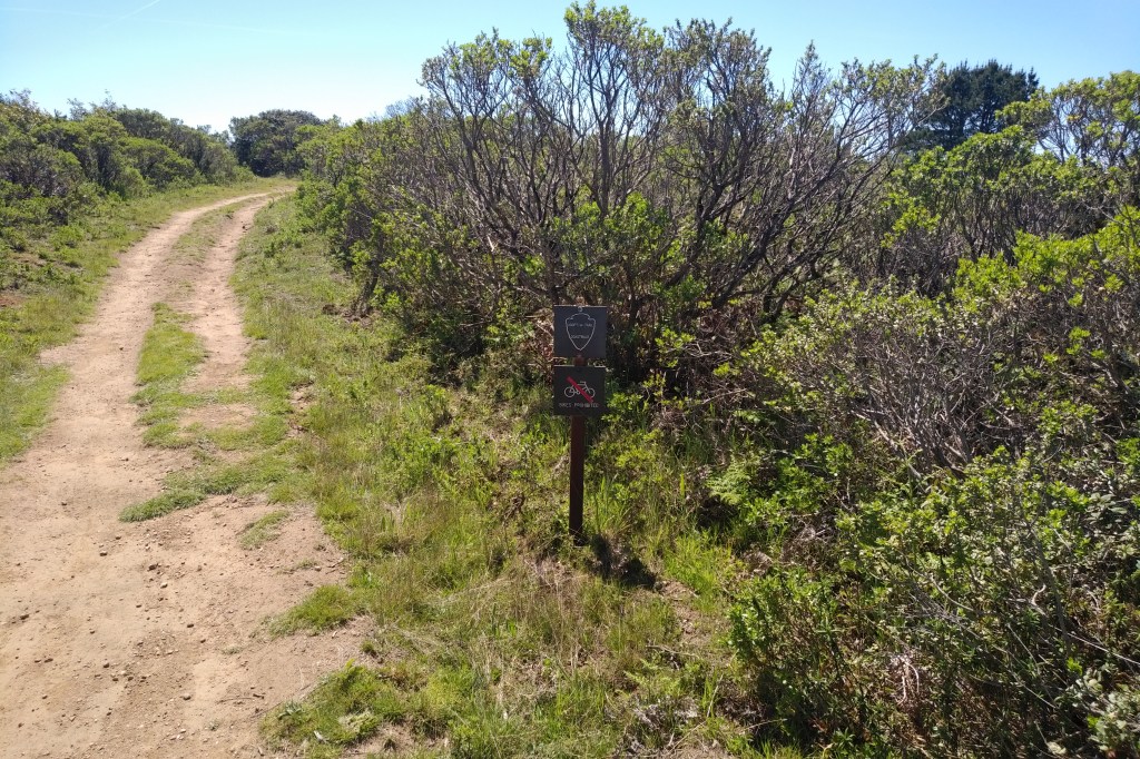
About a half mile from the parking area you come to the intersection of the Inverness Ridge Trail and Bucklin Trail, at this point we left the paved road and walked along Bucklin trail looking for good place to set up the station.

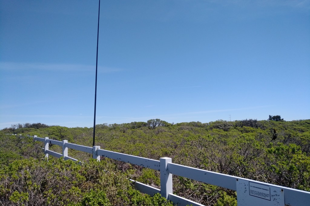
Point Reyes Hill is the location of an FAA VOR facility providing radio navigation for aircraft. The VOR is enclosed within a low white fence. Do not trespass onto this facility, it is an operational NavAid.
Continuing on Bucklin trail around to the west of the VOR, an ideal operating position presents itself just as the trail starts to head back down the hillside. A convenient bench sits close to the fence, which provided a good spot to secure the Spiderbeam mast with bungee cords.
After setting up the radio and antenna I went to spot myself on SOTA, but alas I had no cell signal at all. I tried using the Garmin InReach messaging to talk to the SOTAmāt system at sotamat.com, the satellite message transmission worked flawlessly but my spot was rejected by SOTA!
By this time I noticed that I had acquired a single bar of 4G on my phone and was able to eek out some SMS messages to SOTAmāt. After verifying my summit designation I determined that SOTA did not accept a frequency value of “14” MHz. I resent the spot message as ssm w6.cc.071 14.0615 cw to SOTAmāt, which responded with Spotted: w6csn W6/CC-071 14.0615 CW – I was ready to start calling CQ SOTA for the first time!

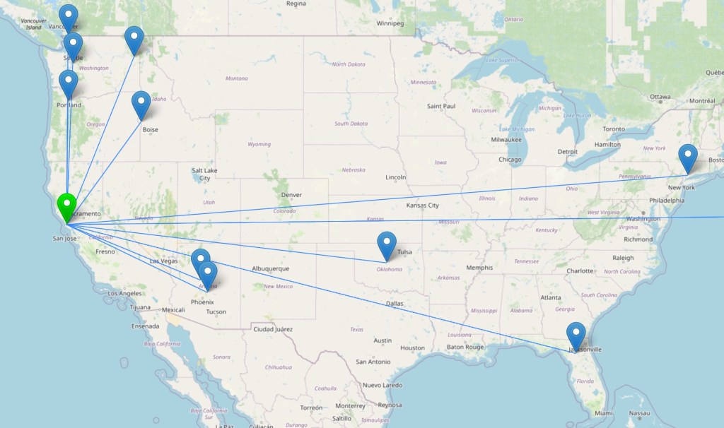
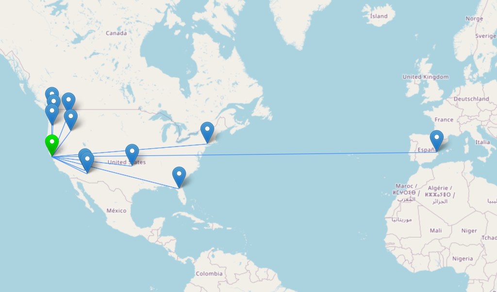
The spotting had its intended effect as I quickly got two S2S QSOs from southern California. After working a few more chasers and another pair of S2S contacts with Lookout Mountain in Washington state (W7W/CW-092) I wrapped up the activation with a total of eight contacts.

I certainly could have stayed on the summit longer but I wanted to yield the bench to other hikers coming up the mountain and I had a POTA scheduled for nearby Tomales Bay State Park. I was happy with a successful activation for my first attempt at SOTA.

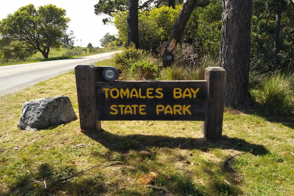
Descending on Mt. Vision Road, we went back in the direction of Inverness then turned north on Pierce Point Road. In a couple of minutes the entrance to Tomales Bay State Park appears on the right.
The vibe on the beach was very different than that of the quiet mountaintop SOTA activation. Lots of families enjoying the warm Saturday afternoon with barbecues, festive music playing from numerous sites, and all sorts of water recreation.

Because the park was crowded, I wasn’t going to go tossing throw lines around or setting up the tall mast. I deployed the Gabil tripod and loading coil with the folding 3 meter “manpack” whip, and three 30 foot radials snaking around the picnic table.
This POTA activation was scheduled ahead of time on pota.app so the RBN picked up my calling on CW and spotted me accordingly. Because it was hot and noisy down at the beach, I worked the 10 needed for a valid activation then sent QRT. One more station jumped in for an 11th QSO before I switched off the radio.
A late lunch and coffee at Point Reyes Station, followed by an hour long drive home finished off this successful day of outdoor amateur radio adventuring.

Leave a comment